UN
162 Wrexham Road
£ 55,000
Description
We don't have a Description for this property.
- Bedrooms
- 2
- Bathrooms
- 0
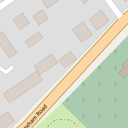
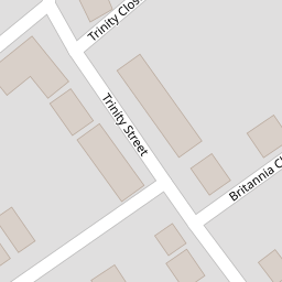
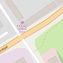

Leaflet © OpenStreetMap contributors
The heatmap indicates the level of crime in the area. The color of the heatmap indicates the crime severity and recency.
Metrics Year-on-Year
- Average area value
- 363,275.00 £Increased by 0.98 %
- Average area rental value
- 922.00 £/moDecreased by 1.28 %
- Est rental Yield
- 3.05 %Decreased by 2.24 %
- Crime Rate
- 64.00 %Unchanged by 0.00 %
from 359,732.00 £
from 934.00 £/mo
from 3.12 %
from 64.00 %
Nearby Schools
| Name | Type | Ofsted | Distance |
|---|---|---|---|
| Rhostyllen C.P. School | Welsh Establishment | 0.19 KM | |
| Ysgol Clywedog | Welsh Establishment | 1.97 KM | |
| St Joseph'S Catholic And Anglican Secondary School | Welsh Establishment | 3.13 KM | |
| Woodlands Children'S Development Centre | Welsh Establishment | 3.20 KM | |
| Ysgol Penrhyn New Broughton Primary | Welsh Establishment | 3.25 KM |
Images
Nearby Streets
| Name | Average Price | Average Sqft | Distance |
|---|---|---|---|
| Trinity Street | £ 115,000 | 0 | 0.00 KM |
| Britannia Close | £ 157,250 | 0 | 0.00 KM |
| Holmwood Avenue | £ 182,500 | 0 | 0.00 KM |
| Tudor Court | £ 0 | 0 | 0.00 KM |
| Burkit Street | £ 0 | 0 | 0.00 KM |
Nearby Transport
| Name | NLC | TLC | Distance |
|---|---|---|---|
| Wrexham General | 4487 | WRX | 3.30 KM |
| Wrexham Central | 4486 | WXC | 3.31 KM |
| Gwersyllt | 4300 | GWE | 4.81 KM |
| Ruabon | 4477 | RUA | 5.18 KM |
| Cefn-Y-Bedd | 2425 | CYB | 7.72 KM |
Nearby Listings
| Address | Price | Type | Score | Distance |
|---|---|---|---|---|
| Wrexham Road, Wrexham, LL14 | £ 135,000 | BUY | Unknown | 0.01 KM |
| Plot 52 - The Gresford, Phase 2, Manor Gardens, Wrexham Road, Rhostyllen | £ 399,950 | BUY | Unknown | 0.01 KM |
| Phase 2, Manor Gardens, Wrexham Road, Rhostyllen, Wrexham, LL14 4DN | £ 275,000 | BUY | Unknown | 0.01 KM |
| Plot 49 - The Derwen, Phase 2, Manor Gardens, Wrexham Road, Rhostyllen, Wrexham, LL14 4DN | £ 365,000 | BUY | Unknown | 0.01 KM |
| Plot 72 - The Richmond 2, Phase 2, Manor Gardens, Wrexham Road, Rhostyllen | £ 390,000 | BUY | 8 / 10 | 0.03 KM |
Nearby Properties
| Address | Price | Distance |
|---|---|---|
| 166 Wrexham Road | £ 62,600 | 0.00 KM |
| 114 Wrexham Road | £ 79,950 | 0.00 KM |
| 176 Wrexham Road | £ 45,000 | 0.00 KM |
| 156 Wrexham Road | £ 92,950 | 0.00 KM |
| 162 Wrexham Road | £ 55,000 | 0.00 KM |